Earlier this year we drove through Nevada on our way to California but the only stop we made was for fuel and restrooms so it didn't feel like we earned our sticker. A friend noticed that our map had a Nevada sized hole and recommended Valley of Fire State Park. I started checking and realized it was only 3.5 hours from our current job in Page, AZ! When Eldon's schedule gave him 7 days off in a row, we took advantage of that and came to check it out.
Freecampsites.net showed multiple boondocking locations in the area. We chose
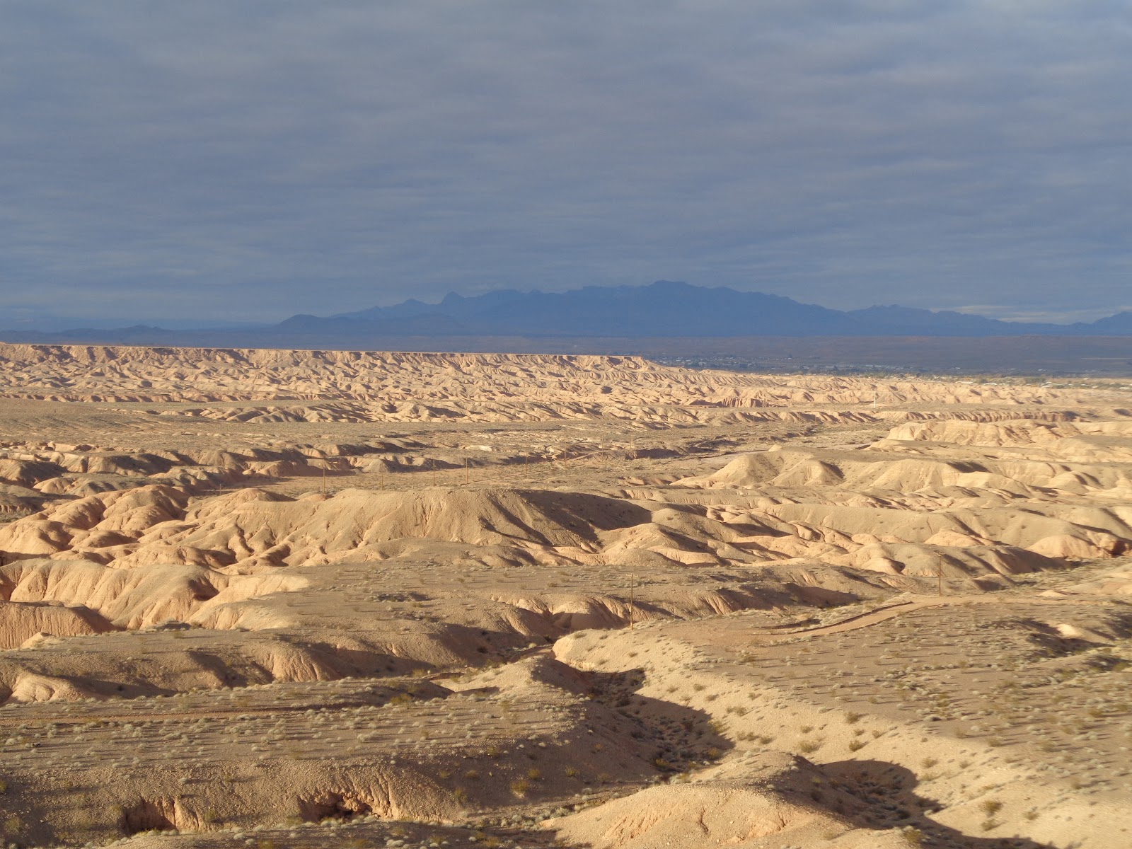
Poverty Flats and were not disappointed. It's a huge area on top of a mesa with incredible views. The downside is that since it's so easy to get to, you won't be lonely. However, there is plenty of space for all, both AT&T and Verizon have great service, it's only a few miles from the entrance of VoF State Park, and did I mention the views are great?!
 |
| Right out our front door. |
 |
| This mountain changes from red to pink to blue in a matter of minutes when the sun is setting. |
 |
| We've enjoyed sitting outside in the evening and seeing and hearing the geese coming in as it gets dark. |
Valley of Fire is Nevada's first State Park, opening in 1934. In 1920 a traveler going through at sunset said "It looks like the whole valley is on fire" and the name stuck. The most obvious evidence of occupation is petroglyphs carved into rocks by the Basketmaker culture about 2,500 years ago. They were followed by the Puebloans, and later still the Paiutes, who were still in the area in 1865 when Mormons settled in nearby Moapa Valley. The years following brought farmers, ranchers, and miners to the valley. In 1912 a rough road was built through the area that connected Salt Lake City and Los Angeles. The road, referred to as the Arrowhead road, was 853 miles long and considered the first all-weather road. In the 1930's, the CCC built the original buildings and campground for the park.
We spent 2 days at the park and hiked 3.5 miles each day. Many of the trails are short so we saw a lot of different features and did a lot of trails!
 |
| Petroglyphs along Mouse Tank Trail |
 |
| Mouse Tank, named for the Paiute outlaw who hid out here for 6 months before lawmen tracked him down. |
 |
| Lots of different cacti plants here. |
 |
| The Rainbow Vista Trail |
 |
| A kind hiker offered to take a family photo for us. |
 |
| Check out that distinct white/red line! |
 |
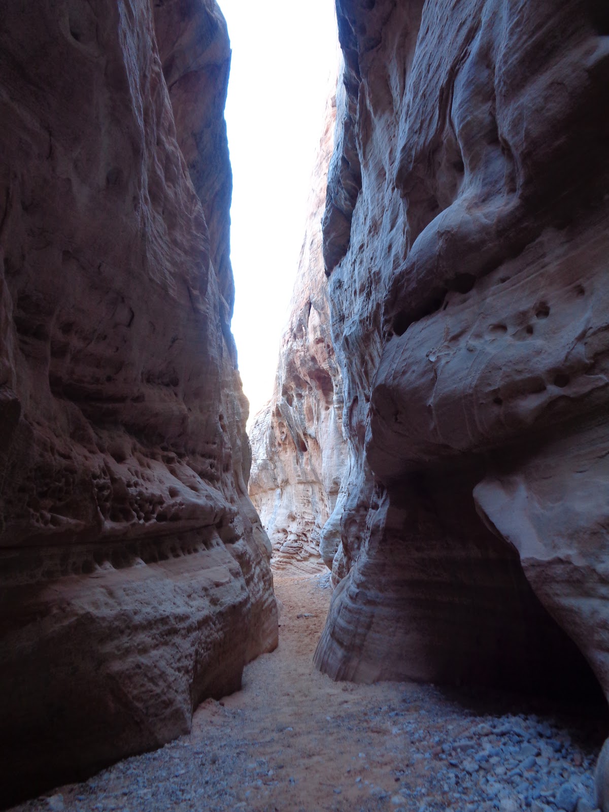
| White Dome Trail had a slot canyon, much to our delight! |
 |
| Looking at the sky far above us! |
 |
| These cracks in the rocks just beg to be explored! |
 |
| It's hard to capture it, but these rocks were purplish. |
 |
| Atlatl Rock had stairs we hiked up to get a closer view of these excellent petroglyphs. |
 |
| Sadly, there is a large amount of graffiti here too. |
 |
| Elephant Rock was Emily's favorite. |
 |
| Sandstone forms incredible shapes and holes as it erodes. |
 |
| The second day we were a bit slower then the first 😉 |
 |
| The Fire Wave Trail had lots of red and white contrasts. |
 |
| We noticed the red sandstone had small, blackish, almost oily rocks laying on top? |
 |
| Small pools of water are a must for survival for animals out here. |
 |
| My favorite picture of the day. |
 |
| Someday I want to come here when all the cacti are blooming! |
 |
| Cabins built by the CCC as a place for travelers to spend the night. |
 |
| They have decided they want a dug-out if we ever settle. Or a stone house. Or a cave. Something unique, for sure! |
The rest of these photos Makayla took (or Michael) with her camera. She takes about 3 times as many as I do and gets some really good shots!
 |
| The visitors center had great exhibits and even some live reptiles. |
 |
| Ethan takes his map skills seriously. |
 |
| Sisters. |
 |
| Friends.....for the moment. |
 |
| The sun was really bright! |


No comments:
Post a Comment